CAA Airspace Regulation Operations for Drone Pilots and Model Aircraft Operators
Please refer to the following: Statutory Instrument 2026 No. 64
The Air Navigation (Restriction of Flying) (Ministry of Defence Prohibited Places) Regulations 2026
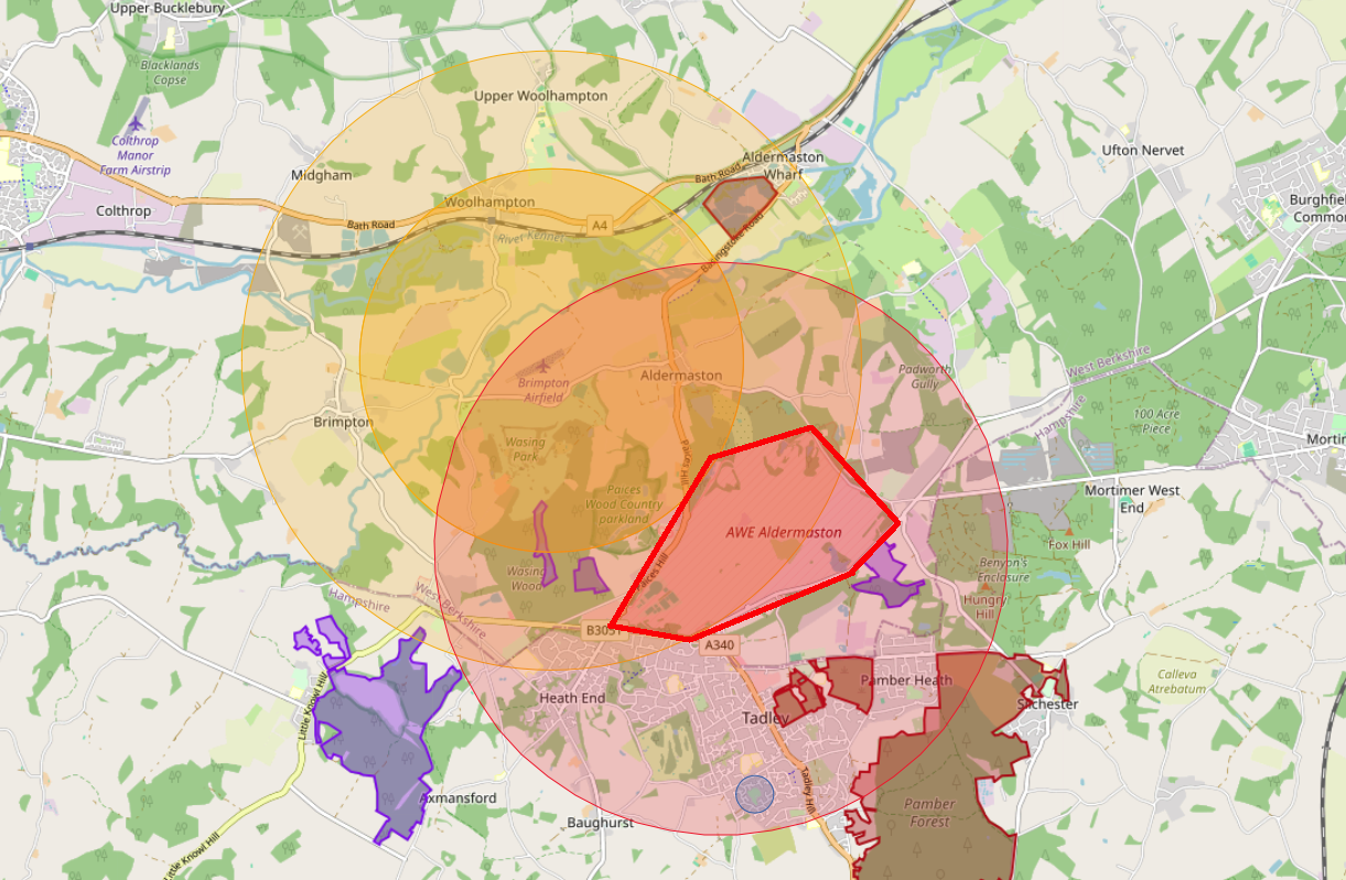
Map courtesy of TheDroneMap.com and FPV UK Ltd
EGRU266 NSA ALDERMASTON. Flight Restriction
VERTICAL LIMITS
Surface to 800 FT ALT
NOTE
National Security Act (Prohibited Place) Restricted Airspace active H24.
Unmanned aircraft flight not permitted
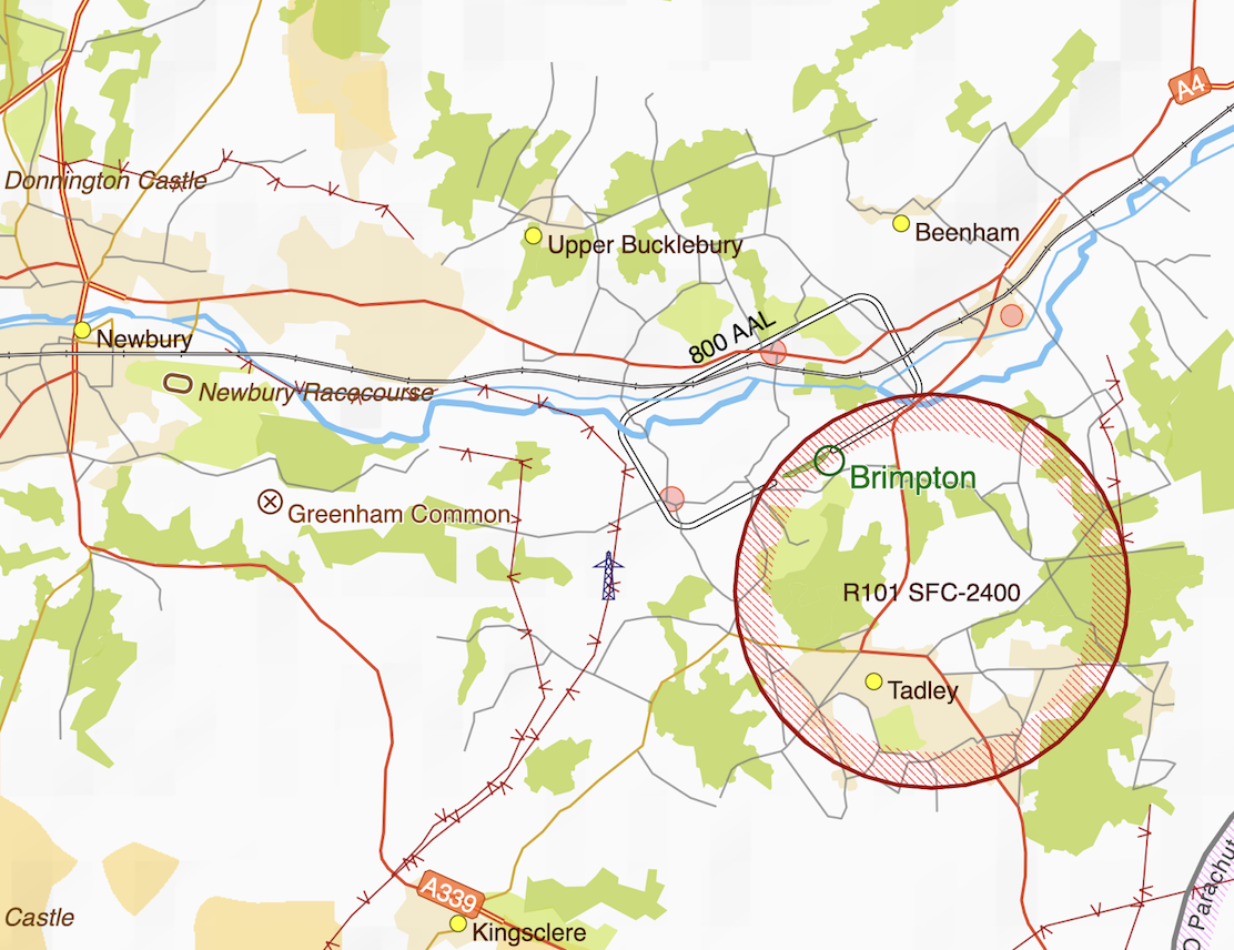
Operating in Restricted Area R101
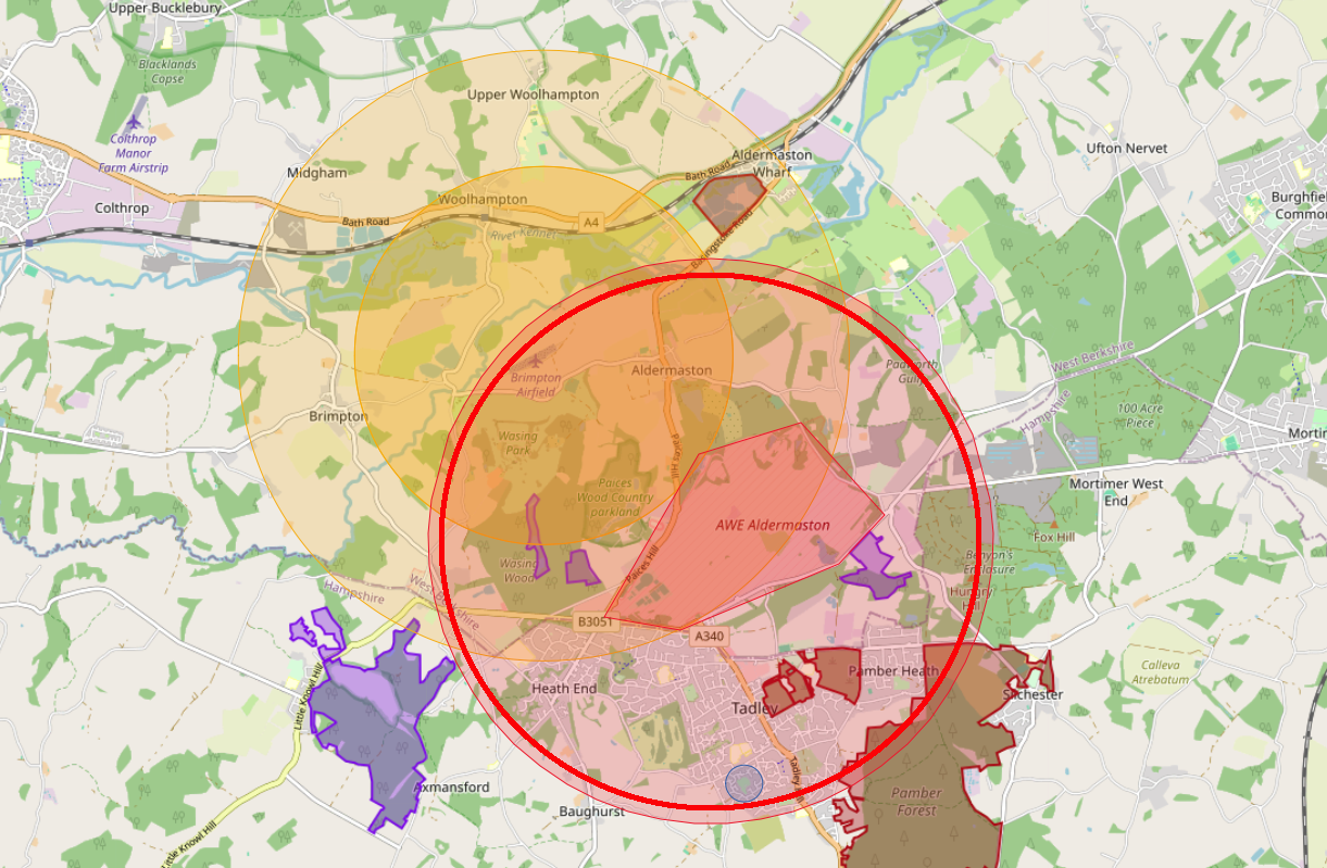
Map courtesy of TheDroneMap.com and FPV UK Ltd
EGR101 ALDERMASTON Restricted Area
VERTICAL LIMITS
Surface to 2400 FT ALT
Operating in Restricted Area R101 requires permission from the CAA, NSA ALDERMASTON and BRIMPTON AIRFIELD
Nothing on this website shall replace Official Published information and is for guidence only. The extent of any airspace restrictions are officially published through United Kingdon Aeronautical Information Services website and should be referenced for briefing purposes. Brimpton Airfield can take no reponsibility if the information on this site is not current to the official information.
July 2026